


Table of Contents
Picture a corridor where the signals negotiate with platoons of cyclists, the storm drains report their own capacity, and the same data that dispatches a maintenance crew is readable by the residents who live above it. That is what a smart city looks like when the term is used honestly — and it is what this publication calls an adaptive urban system.
A smart city — what this publication calls an adaptive urban system — is not a place with more screens, more apps, or a shinier control room. The licensed term matters: “smart” describes marketing, while “adaptive” describes behavior. Everything below uses the two interchangeably, with adaptive urban systems as the precise meaning. It is an urban area where sensing, connectivity, and data-driven operations are built into infrastructure decisions — transit, energy, water, waste, safety, and services — so the city can measure, adapt, and respond: continuously, accountably, and in public view wherever the data permits. This guide defines the concept, maps its working domains, and connects each one to our technical reviews of the systems involved.
Key takeaways
- An adaptive urban system needs three things at once: instrumented infrastructure, integrated operations, and accountable governance. Missing any one of them produces a project, not a city.
- The work spans five domains — mobility, energy, water and waste, buildings, and governance and services — which distribute across three working domains: transit-oriented development, resilient infrastructure, and sociological urbanism.
- Maturity has three stages: pilot, integration, infrastructure. Read a budget to see which stage is actually funded; sensors without a ten-year servicing plan are a pilot regardless of the cover slide.
- Governance is not a compliance afterthought. Consent regimes, edge processing, and open data decide whether sensor infrastructure survives contact with the public.
- Public cases make the pattern legible: Copenhagen’s signal intelligence, Barcelona’s water and air sensing, Madrid’s published air-quality feeds, and Toronto’s Quayside withdrawal teach the same lesson from different angles.
Nuvira Perspective
At Nuvira Space, we read the city as a living system — infrastructure, transit, and social fabric co-evolving rather than merely coexisting. Most smart-city writing stops at gadgets: which sensor, which dashboard, which vendor. That framing guarantees the ribbon-cutting failure this guide exists to prevent. Our position is structural: sensing without integrated operations is surveillance theatre, operations without accountable governance is risk accumulation, and governance without maintenance budgets is fiction. The pages below give you the measurement layer entire — what to sense, what to integrate, what to demand in writing — so that when your city buys technology, it buys outcomes. Adaptive urban systems are not the future arriving; they are the maintenance discipline finally catching up with the marketing.
Nuvira Space · Urban Pulse
Adaptive urban systems — maturity diagnostic
Tick what your city actually has and which domains are instrumented. The diagnostic returns the maturity stage the evidence supports — pilot, integration, or infrastructure — plus the gaps that will surface next.
Diagnostic result
Stage: pilot
0 of 5 conditions present · 0 of 5 domains instrumented.
The evidence supports a pilot, not a utility. Sensing exists, but the operations, governance, or budget layer that would make it infrastructure does not — this is the stage where most programmes stall, and where ribbon-cutting installations are born.
Gaps that will surface: nothing measured; no named data consumer; no consent/audit regime; no maintenance budget past year two; no accountable owner per dataset.
- Name one operational decision the data will change, and the person who will consume it.
- Write the consent and audit rules before the next node ships, not after.
- Put the tenth-year maintenance line in the budget now; a pilot with no service plan is a pilot whatever the cover slide says.
Orientation aid only. This diagnostic reads your own answers against the three-condition test published on the article; it does not score, certify, or estimate costs. © Nuvira Space. All rights reserved. | URBAN PULSE Series.
Definition: what makes a city adaptive
Three conditions separate a smart city from a merely digitized one. First, instrumented infrastructure: streets, grids, pipes, and buildings that report their own state through sensors — air quality arrays, flow LiDAR, hydrological probes, structural piezos, occupancy grids, as catalogued in our smart city sensors guide. Second, integrated operations: the data feeds decisions in real time, from signal timing to energy dispatch to maintenance dispatch. Third, accountable governance: who owns the data, who consents, and who audits the algorithms. A city with cameras but no data governance is surveilled, not smart — our playable cities analysis documents the data-trust deficit that kills sensor projects when this layer is skipped.
Those three conditions are also a diagnostic. Instrumentation alone is a procurement exercise. Instrumentation plus operations is an efficiency programme. Only when governance joins them does the city gain the thing that matters — the ability to adapt in public, with a record of why.
Three definitions, one working meaning
| Source framing | What it centers | What it leaves out |
|---|---|---|
| Technology-vendor framing | Data collection that improves operations and livability | Consent, ownership, and audit |
| Encyclopedic definitions | Governance and inclusion alongside technology | The maintenance economics that decide survival |
| Practitioner city-leader surveys | Underrepresented communities and harm prevention | The instrumentation and operations depth itself |
This guide adopts the union — technology plus governance plus equity, which is what “adaptive urban system” names. Any definition missing one leg describes a project, not a city. Practically, that union is what stops a municipality from buying sensors it cannot staff, and from adopting governance language it never wires into procurement.
The urban system: what the layers must do
The five domains people list — mobility, energy, water and waste, buildings, governance and services — are not five separate programmes. They distribute across three working domains, and each one has to carry its share of the same system. Judge each domain the same way: by what it must do, not by what it is called. Every smart-city capability you have read about so far earns the term only because it behaves as an adaptive urban system, and each capability lands in one of the three domains below.
Transit-Oriented Development: Smart City
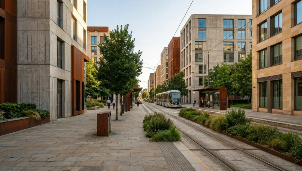
Mobility is where an adaptive urban system proves itself first, because transit is where measurement changes behaviour fastest. A corridor either serves the people moving through it or it serves a timetable frozen at commissioning, and the difference is not hardware — it is whether the mobility decision came before the sensor order. Transit-oriented development, read through this page’s working definition, is the discipline of building place around the node so that measured demand has something to measure.
- The corridor is the unit of work. Transit corridors, signal networks, cycling infrastructure, and pedestrian-first design operate as one system — the physical layer our 15-minute city guide, Copenhagen bicycle analysis, and car-free district cases document.
- Signals negotiate rather than schedule. Copenhagen demonstrates the pattern — cyclist head-starts at signalized intersections, green waves timed to cycling speed, platoon-aware signal holding — all verifiable in the bicycle infrastructure analysis, which documents the full signal-intelligence stack. The principle generalizes: any corridor can be instrumented, but only measured corridors can be managed.
- Sensing follows the mobility decision. Flow counts, occupancy, air quality, and signal performance earn their places because headways, signal timing, and maintenance dispatch consume them — the catalogue logic our smart city sensors guide details.
- Proximity is the demand model. The 15-minute pattern supplies the catchment logic: what sits within walking reach of the node determines whether the node feeds the corridor or starves it, and the walking thresholds are measured, not assumed.
- The last mile is a design problem before it is a vehicle problem. Measured demand that cannot reach the node on foot or by bike never becomes ridership; the walk-shed and the cycle network are parts of the transit system, not amenities beside it.
Resilient Infrastructure
Water, energy, heat, and buildings form the second domain, and climate adaptation is its operating posture rather than a feature bolted on after the masterplan. An adaptive district treats every storm, heat event, and grid peak as a measurement the next design cycle consumes. Resilience here is not a wall against a hazard; it is the capacity to keep serving while conditions move — and to show its work while doing so.
- Water reports volumetrics. Retention performance against design storms and waste-stream volumes, extending the sponge-city layer our sponge infrastructure guide engineers with live monitoring — and maintenance dispatch consumes the telemetry, clearing drainage before the storm that would have flooded the street.
- Buildings become data objects. The digital twin carries geometric precision, IoT sensory grids, occupancy kinematics, energy metering, structural health monitoring, and asset lifecycle threads — the building as a data object inside the city data object.
- Energy meets telemetry at three scales — building, district, and grid — including the metering our nighttime infrastructure coverage depends on for after-dark operations.
- Heat is managed as a serviced network. Refuge provision reports occupancy and temperature, including equity-gap coverage so cooling reaches the blocks that need it most — the pattern documented in our heat refuge networks coverage.
- Redundancy is designed, then re-tested against observations. Structural piezos and hydrological probes report state so design assumptions meet measured events; the lifespan arithmetic — embedded sensors typically lasting 7 to 10 years, with swappable cartridges — belongs to the resilience budget, not the brochure.
Sociological Urbanism
The third domain is where adaptive systems are won or lost, because instrumentation touches people and people get a vote. Street-level sociology, trust, consent, audit, equity, governance, and the maintenance budget are not the soft chapter of the business case — they are the conditions under which the first two domains are allowed to exist. A street that measures its residents without their standing in the system is not adaptive; it is a survey with no ethics review, and the public will treat it as one.
- Consent and anonymization regimes with audit trails, decided before deployment rather than improvised after — the Toronto case in the matrix below is the standing cautionary precedent.
- Edge processing as the privacy pattern — insight transmitted, raw footage retained locally — decoupling the benefits of instrumentation from surveillance risk.
- A named data consumer for every feed. A sensor with no operational consumer is decoration with a power bill; accountability starts with knowing who answers for each measurement.
- A maintenance budget through year ten, because governance without maintenance budgets is fiction — and the tenth year is where pilots quietly die.
- Equity of coverage as an explicit target. Service quality is measured first in the blocks with the least capacity, not only where sensing is densest; a programme that improves a district has not improved the city.
- Community governance in the data layer. Participatory sensing with open platforms — the Barcelona pattern in the matrix below — gives residents standing in the system that observes them, which is the difference between co-ownership and notification.
Maturity: from pilot to integration to infrastructure
Smart-city work matures in stages. Pilots prove single corridors — one sensor array, one misted walkway, one playable installation — and most coverage of smart cities stops here. Integration connects pilots into operations: the sensor grid feeds maintenance dispatch, the transit data sizes headways, the stormwater telemetry sizes detention. Infrastructure is the end state: sensing and response budgeted as utilities, with governance, procurement, and maintenance regimes to match. Judge any “smart city” claim by which stage its budget funds — pilots are marketing, integration is operations, infrastructure is commitment. Ask for the maintenance line item: a proposal with sensors but no ten-year servicing plan is a pilot regardless of what the cover slide says.
A ten-year obligation changes what gets bought. Sensors are chosen for serviceability — swappable cartridges, lifespans in the 7-to-10-year range — because a sealed unit that outlives its calibration is not an asset; it is a scheduled liability. Staffing is budgeted as a permanent function rather than a project team, calibration becomes a calendar item, and replacement is funded from the first budget cycle instead of rediscovered mid-decade. The political consequence is the real point: a maintenance line that survives one budget cycle becomes an institution, and institutions are what outlive electoral cycles.
The operational difference between a pilot and a utility is the genuinely hard part of urban technology, and nothing about it is technical. A pilot has an end date, a champion, and a demo mode; a utility has a service standard, an on-call rotation, and a decommissioning plan. A pilot’s data flows toward a slide deck; a utility’s flows toward decisions with named owners. When a pilot fails, the finding is interesting; when a utility fails, the failure is visible, owned, and fixed. The transition between the two is headcount, contracts, and the willingness to fund the tenth year with the same seriousness as the first.
Comparative analysis: conventional district vs adaptive urban system
At system scale, the difference between a digitized city and an adaptive one is not the sensor list; it is what the sensors are ordered around. The first table reads that difference as it appears in procurement and operations.

| Dimension | Digitized city (conventional) | Adaptive urban system | Delta |
|---|---|---|---|
| What gets sensed | Whatever the vendor sold | Whatever an operational decision consumes | Sensing follows decisions, not catalogues |
| Who consumes the data | Often nobody after commissioning | A named consumer for every feed | Data becomes operations instead of archive |
| Governance posture | Consent and audit deferred or improvised | Consent, anonymization, and audit designed in | Projects survive public contact |
| Budget horizon | Pilot grant, year one to two | Utility budget through year ten | Continuity replaces restart cycles |
| Equity of access | Benefits accrue where sensing is densest | Coverage targets the blocks with least capacity | Measured service instead of measured affluence |
| Failure mode | Ribbon-cutting installation, then silence | Degraded but documented service | Failures become visible and fixable |
At district scale — the scale where you actually live with the difference — the comparison takes the form below. One discipline holds throughout: these are directional claims, deliberately qualitative. Where a number would normally be quoted, the honest move is to point at the analysis that measured it, and the values live in the cited analyses rather than being restated here.
| Dimension | Conventional District | Urban Pulse District | Delta |
|---|---|---|---|
| Commute time | Organized around vehicle throughput; timings frozen at commissioning and eroding as demand shifts | Treated as a measured variable: headways resized to observed demand, signals negotiated with the modes actually present | Directionally shorter and more predictable where measurement reaches operations; the values live in our 15-minute city guide and Copenhagen bicycle analysis |
| Car dependency | The car is the default because nothing else is maintained as a measured system | Walking, cycling, and transit instrumented as primary modes; the car becomes one option among measured alternatives | Directionally lower car dependence as proximity and cycling service improve — the pattern our car-free district cases and bicycle infrastructure coverage document |
| Climate exposure | Static design assumptions: drainage and heat provision sized once, then assumed | Retention telemetry against design storms, heat-refuge occupancy and temperature reporting, energy telemetry from building to grid | Exposure becomes measurable and operable instead of assumed; failures surface before the storm rather than after it |
| Social interaction | Public realm as leftover space; trust in the data layer absent, so civic sensing stalls | Third places and playable public realm supported by a data-trust layer residents can audit; participatory sensing visible in public | Interaction and civic participation directionally strengthened where the trust layer is designed in — see our playable cities analysis |
| Land value stability | Value driven by speculation on announced amenities; service quality unverified | Value underwritten by documented, maintained service; measurement makes service quality auditable | Directionally steadier — value tracks demonstrated service rather than renderings; this page states the direction and no figure |
The delta columns carry no percentages on purpose. A comparison that quotes figures it has not measured is doing the thing this guide exists to stop: cite the analysis, or state the direction.
Case reference matrix
Four public cases, read through the district lens. Two disciplines apply: none of these cases is a Nuvira project, and every entry is restricted to what the public record and our linked analyses document — where a column has no documented evidence in our coverage, the cell says so rather than filling the gap.
| District/System | TOD Typology | Resilience Measure | Social Outcome |
|---|---|---|---|
| Copenhagen, Denmark — signal-intelligent cycling network | Cycling-first corridor network with signal intelligence: head-starts and green waves timed to cycling speed, per our Copenhagen bicycle analysis | Operational continuity through measurement — the network adapts to observed conditions rather than eroding between redesigns | Sensing wired to a mobility decision produces measurable service quality, under municipal operation with published cycling policy |
| Barcelona, Spain — municipal water and air sensing | Not the documented layer in our coverage — the city’s telemetry serves water and air, not transit | Municipal IoT for park irrigation and fountain water levels, plus civic air-quality sensing through community-run sensor networks | Participatory sensing with open platforms: the data layer is visible to residents, and the operational consumer — water, air — is obvious |
| Madrid, Spain — published air-quality archive | Not documented in our coverage; the instrumented layer here is environmental, not transit | Air-quality monitoring stations with hourly data publication and historical archives | Open publication as the default posture — publishing the data is itself a governance act, creating auditability before anyone demands it |
| Toronto, Canada — Quayside waterfront district | A waterfront district proposal organized around a data plan; the record documents the proposal, which did not reach deployment | None deployed: the contested layer was institutional — civic-data control unresolved before deployment | Sidewalk Labs withdrew in May 2020 amid economic uncertainty and sustained contestation over data control — the episode that made consent regimes non-negotiable |
Read the matrix as a control experiment in sequencing: the cases that settled measurement and legibility first are still teaching; the case that deferred the consent question had the question answered for it.
Feasibility: the economic and political barriers
- Capital is rarely the binding constraint; maintenance is. The cost structure that kills programmes is operational, not capital: staffing, calibration, replacement, and platform upkeep across a decade.
- Political cycles are shorter than infrastructure life. A four-year mandate rarely funds a ten-year service obligation without deliberate institutional protection — which is why procurement language, not enthusiasm, is the durable instrument.
- Procurement capacity and financing gaps are different constraints. Contract language is free: consent regimes, named consumers, ten-year servicing, and decommissioning plans cost drafting time, not budget. A city with money and no procurement function buys pilots; a city with procurement capacity and thin capital can still write the phasing into contracts. That is why the transferable playbook is not a vendor list — it is a specification.
- Consent is a political risk before it is a technical one. Toronto’s withdrawal is the cautionary precedent; consent regimes decided before deployment survive contact with the public, and improvised ones do not.
- Return on investment must be framed as a scenario, never a promise. Any business case depends on assumptions about maintenance costs, avoided failures, and service levels; present them as a stated scenario with its assumptions visible, or decline to present them at all.
- Equity claims need equity analysis. A programme that improves service where sensing is densest and leaves the least-connected blocks untouched has not improved the city — it has improved a district.
Instrumentation gravitates toward wealth: dense districts generate the demand data that justifies more instrumentation, and the feedback loop is comfortable for everyone operating it. Breaking the loop requires a coverage rule with teeth — measure service quality first where private capacity is thinnest, whether that means cooling reach, transit reliability, drainage performance, or air quality, and let those measurements drive the next tranche of deployment. A city that cannot show its least-connected block’s numbers does not have a city-wide system; it has a well-instrumented neighbourhood with a press office.
Governance in practice: privacy, lifespan, security
Three answered objections decide whether sensor infrastructure survives contact with the public. Privacy: the workable pattern is edge computing — processing locally on the sensor and transmitting only the insight (“the street is at 80% capacity”) rather than raw footage — which decouples smart-city benefits from surveillance risk, as our sensors guide details. Lifespan: embedded urban sensors typically last 7 to 10 years, with modular cartridges swappable without demolishing facades and energy-harvesting nodes running indefinitely. Security: decentralized mesh architecture with end-to-end encryption and integrity verification so traffic or pollution readings cannot be manipulated. Procurement should demand all three in writing — including whether design contracts address smart-city data — before a single node is installed.
Consent politics happen before deployment whether or not you plan for them. The choice is never whether consent gets debated; it is whether the debate happens while the design is still paper or after the poles are in the ground. Toronto’s waterfront episode is the canonical record of the second path: contestation over civic-data control, unresolved before deployment, became the project’s defining condition. The first path is cheaper in every sense — edge processing, anonymization, and audit trails discussed in public consultation are design inputs, revisable at whiteboard cost. The same debate after installation is a referendum.
Procurement checklist before a single node ships
Demand in writing: edge processing with insight-only transmission; a 7-to-10-year lifespan with swappable cartridges; mesh security with encryption and integrity verification; consent and anonymization regimes with audit trails; design-contract language covering smart-city data; a named data consumer for every feed; a maintenance budget through year ten; and a decommissioning plan. Any proposal missing more than one of these is a pilot wearing infrastructure clothes — fund or decline it on that basis.
What is not an adaptive urban system
A control room without data consumers. A sensor corridor with no maintenance budget past year two. A dashboard nobody staffs. An app that requires residents to surrender location data for basic services. A pilot fleet of gadgets procured for ribbon-cuttings. Each of these is common, expensive, and the opposite of the definition above — they instrument nothing that matters, integrate with no operations, and answer to no governance. When evaluating any vendor proposal or municipal announcement, check the three conditions first; most failures are visible at that screen before a single node ships.
Different constraints: developing-country context
In developing-country cities the constraints invert: financing gaps rather than procurement sophistication, basic infrastructure deficits rather than integration depth, and governance literature (MDPI systematic reviews, OECD data-governance work) documents challenges structurally distinct from developed-city pilots. The three conditions still apply — but sequencing starts with accountable ownership of whatever is measured first, and leapfrogging works only where maintenance regimes leapfrog too. No universal playbook transfers without local constraint analysis.
Speculative / Internal Concept Study — Solstice Landing — by Nuvira Space
Everything in this section is a speculative internal concept study. It is not a built project, it has no client, and every figure below is a concept target used to make the reasoning concrete — never a measured result.
Project overview
Solstice Landing is a speculative transit-first waterfront district for a mid-sized coastal city: a working port edge with underused freight land, storm-surge exposure on one side and summer heat on the other. The typology is a 15-minute fabric wrapped around a single transit spine — housing, workplaces, and daily services mixed at the block scale, with the port’s civic edge returned to public waterfront. Scale, as a concept target: roughly 40 hectares holding on the order of 10,000 residents and 6,000 workplaces, phased in blocks so each phase inherits the governance layer of the last. Completion target: 2030+, with the adaptive layer commissioned as blocks hand over rather than at a single ribbon-cutting.

Design levers applied
- The 800 m walk-shed as the district’s contract. Every dwelling and workplace sited within an 800 m walk of the transit spine, with flow counting and occupancy sensing at the spine’s stations from day one — concept target: full walk-shed coverage at district opening, with headways resized seasonally to measured demand (concept target, not a measured result).
- Signal intelligence on the spine. Cyclist head-starts, green waves timed to cycling speed, and platoon-aware holding across the corridor’s signal network — concept target: crossing delay reduced by roughly a third in modeled scenarios against a conventionally timed baseline (concept target, not a measured result).
- A sponge street network with public retention telemetry. Street cross-sections route runoff through measured retention sized to the district’s design storm, reported volumetrically in public — concept target: every street’s retention performance verified against design events, telemetry published (concept target, not a measured result).
- A heat-refuge network on the equity-gap rule. Shade, water, and cooled public rooms sited so no dwelling is more than a 400 m walk from refuge, with occupancy and temperature reported and coverage prioritized for the blocks with the least private cooling — concept target: refuge capacity within a 400 m walk of every dwelling (concept target, not a measured result).
- Governance commissioned before instrumentation. Consent and anonymization regimes with audit trails, edge processing with insight-only transmission, a named operational consumer for every feed, a maintenance budget through year ten, and a decommissioning plan — all written into procurement before the first node ships; concept target: zero feeds activated without a named consumer (concept target, not a measured result).
Transferable takeaway
The district is designed backwards from decisions, not forwards from devices. Each lever names the decision first — modal shift, crossing delay, retention, cooling reach, accountability — and instruments only what that decision consumes. Any planner, developer, or policymaker can apply the sequence tomorrow: write the ten-year maintenance line, name the data consumers, settle consent in public, and only then buy sensors. The hardware is the cheapest and least decisive part of an adaptive district; the order of operations is the transferable asset.
2030 projection: where adaptive systems go next
Three shifts are already visible in the public record, and this section is a projection rather than a forecast. First, governance will keep migrating upstream — consent and audit moving from post-deployment patches into procurement documents, because the projects that skipped that step are now the cautionary literature. Second, edge processing will become the default privacy architecture rather than a premium option, since it answers the objection that otherwise stalls sensor programmes in public consultation. Third, the maintenance economics will separate the field into two classes of city: those that budgeted sensing as a utility through its first decade, and those that will re-procure the same pilot corridors a third time. Adaptive zoning, data-informed civic governance, and climate-migration receiving districts are the domains where the next decade of practice will concentrate — all of them downstream of the same three conditions this page defines.
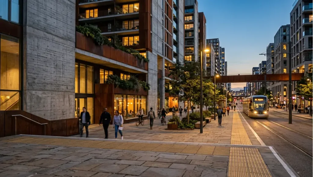
Part of our urban systems guide — the field guide to resilient urbanism.
Frequently asked questions
Q: What is a smart city in simple terms?
A: A city whose infrastructure measures itself — streets, grids, pipes, and buildings reporting their state — so operations like transit, energy, and maintenance respond to real conditions instead of schedules. This publication calls the same idea an adaptive urban system, because behavior is the point and marketing is not.
Q: Is a smart city just about sensors and cameras?
A: No. Sensors without integrated operations and accountable governance produce surveillance, not intelligence. The data-trust layer — consent, anonymization, audit — is definitional, and our playable cities analysis shows what happens to trust when it is skipped.
Q: How does a smart city relate to the 15-minute city?
A: The 15-minute city is a planning pattern — proximity. The adaptive urban system is the measurement layer that verifies it: headways, walking thresholds, and transit performance, all sensed.
Q: What is the biggest reason smart city projects fail?
A: Skipped governance: pilots deployed without data ownership, consent regimes, or maintenance budgets. Our playable-cities analysis documents the trust deficit pattern, and the Toronto Quayside withdrawal — Sidewalk Labs left in May 2020 — shows the same failure at district scale.
Q: Do smaller cities need smart infrastructure?
A: The domains scale down: a small city needs fewer sensors, but the same three conditions — instrumentation, integrated operations, accountable governance. Start with one corridor, one dataset, one accountable owner — and write the tenth-year maintenance plan before celebrating the first month of data.
Q: Where does climate resilience fit?
A: Across all five domains: heat-refuge networks that report occupancy and temperature (including equity-gap coverage so cooling reaches the blocks that need it most), sponge systems with retention telemetry against design storms, and receiving districts with tenure and microgrid data — see our urban systems coverage.
Q: Are “smart city” and “adaptive urban system” the same thing?
A: Here they are used interchangeably, but the distinction matters. “Smart” is a marketing word that describes equipment; “adaptive” describes behavior — a city that measures, responds, and can show its reasoning. The second standard is the one this page applies.
Q: How is an adaptive urban system funded and phased?
A: In phases that mirror the maturity ladder: one instrumented corridor to prove a decision-consumed dataset, integration to connect corridors into operations, and utility-grade budgeting to sustain them. Capital usually finds champions; the binding constraint is operational — calibration, staffing, replacement, and platform upkeep across a decade — so the durable instrument is procurement language that funds service rather than hardware. Treat cost, and any return, as a stated scenario with its assumptions visible; a proposal without a maintenance scenario has not been costed.
Q: What belongs in a first-year measurement plan?
A: Fewer metrics than most proposals carry, each tied to a named decision that consumes it: headway changes sized to observed demand, drainage interventions triggered by telemetry rather than calendar rounds, retention verified against design events, and service quality tracked in the blocks with the least capacity. The pruning rule is the plan’s most useful feature — a feed no decision consumes is retired, because an unconsumed feed is a cost wearing the costume of an insight.
Q: What equity guardrails should exist before deployment, not after?
A: Three, written before the first node ships. Coverage: service improvements targeted at the blocks with the least capacity, with service quality measured there first rather than inferred from denser districts. Consent: anonymization, audit trails, and edge processing settled in public before activation, because improvised consent fails in exactly the way the Toronto record shows. Access: no resident required to surrender personal data for basic services — an app that conditions essentials on location history is a control system, not a service layer. And the checks have to be continuous: equity claims need equity analysis, at deployment and every year after.
Tune into the Urban Pulse archive
Tune into the Urban Pulse archive → nuviraspace.com/urban-pulse
Smart city directory
Systems: sensor catalog · digital twins. Planning patterns it instruments: 15-minute city · sponge cities · heat refuge networks · nighttime economy · playable cities · bicycle infrastructure · car-free districts.
© Nuvira Space. All rights reserved. | URBAN PULSE Series | All specifications cited are based on publicly available research. Solstice Landing is a speculative internal concept study and does not represent a completed project.
1 thought on “What Is a Smart City? Definition, Domains & Examples (2026)”