

Table of Contents
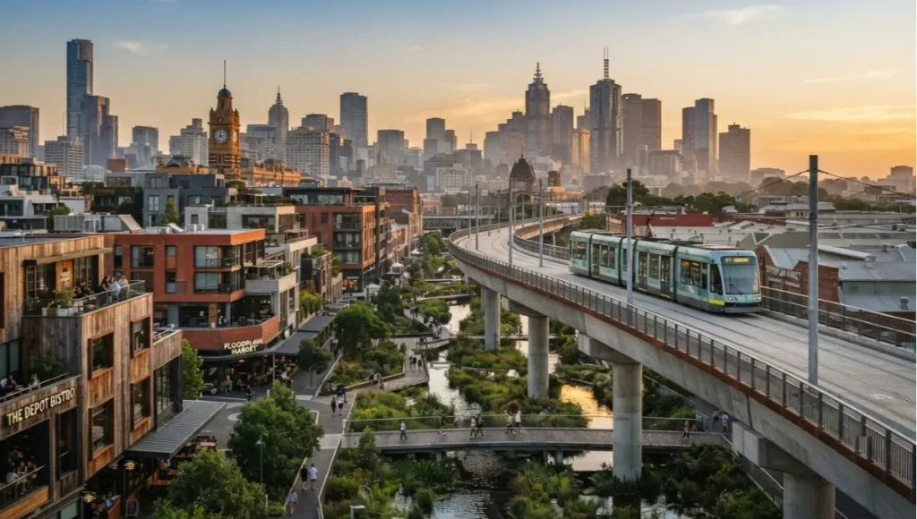
You have toured enough masterplans dressed up as visions to know the pattern by heart: shift the poor a few kilometers past the last transit stop, rename the district something aspirational, and call it renewal. Mystic Outlands Architecture rejects that script outright. It asks what happens when the land nobody wanted — the drainage corridor, the ex-industrial verge, the forgotten transit spur — becomes the site where a city tests what it actually owes the people who live inside it. This is not a listicle of pretty facades. It is a working argument about how the edges of your city could be doing more civic labor than the center ever has.
KEY TAKEAWAYS
• Mystic Outlands Architecture treats the periphery — drainage corridors, ex-industrial verges, forgotten transit spurs — as primary civic infrastructure, not overflow housing.
• Transit-oriented development is the load-bearing wall of the entire approach; remove the transit spine and an outland district becomes a scenic cul-de-sac.
• Rotterdam’s water-plaza network, Singapore’s Tengah forest town, and Copenhagen’s Nordhavn each field-test a design lever this article assembles into a single framework.
• The binding constraint is almost never engineering. It is land speculation, fragmented zoning authority, and election cycles shorter than a construction timeline.
• Nuvira Space’s internal concept study, Threshold Commons, compresses these levers into a template a mid-size city could fund inside a single budget cycle.
Nuvira Perspective
At Nuvira Space, we have argued for years that “mystic” and “masterplan” are not natural enemies. They are simply two words that planning departments stopped using in the same sentence once zoning became an actuarial exercise rather than a spatial one. Our position is that the recalibration of the metropolitan fabric is no longer a matter of drawing prettier towers. It is a matter of instrumenting the city so densely that its water tables, transit headways, and pedestrian desire-lines start behaving like a single organism rather than three departments that do not share a server.
We call this human-machine synthesis, and we treat it as the actual authority claim behind everything we publish under the Urban Pulse banner. A sensor network under a boulevard is not an amenity; it is the nervous system of a neighborhood that can finally tell you, in real time, whether its infrastructure is failing before a resident has to. Mystic Outlands Architecture, in our reading, is what happens when that nervous system is extended past the postcard center of a city and into the terrain planners have historically abandoned — the outlands, in the literal sense.
This is where Nuvira Space’s data-driven design philosophy earns its keep: not in the atrium of a flagship tower, but in the drainage easement three kilometers from the nearest metro stop, where a resilient, sensor-informed intervention can do more redistributive work than another luxury development ever will.
The “Blueprint” Solution
A Blueprint, in the Nuvira sense, is not a rendering. It is a repeatable stack of design decisions that turns a marginal outland parcel into a functioning extension of the city’s transit, water, and social infrastructure. The stack has three layers, and none of them work in isolation.
It is worth being explicit about what the Blueprint is not. It is not a stylistic movement, and it has no interest in a signature silhouette or a recognizable material palette licensed out to a developer’s marketing department. Where conventional flagship architecture asks you to notice the building, the Blueprint asks you to notice the sequence — which infrastructure arrived first, which agency approved it, and which resident group was consulted before the concrete was poured. A Blueprint that photographs beautifully but was built after the housing rather than before the transit has already failed on its own terms, regardless of how the final elevation reads in a magazine spread.
Layer One: The Transit Spine
Every outland site this movement takes seriously sits within an eight-minute walk of a transit node that did not previously justify its own existence. You do not build the mystic tower first. You build the tram extension, the light-rail spur, or the bus-rapid corridor first, and you let the architecture answer to it. This single sequencing decision is the difference between a district that thrives and one that becomes a car-dependent enclave with an expensive skyline.
Specifications typically applied
- Maximum 400-meter catchment radius from any residential entry to a transit stop, per TOD standard practice.
- Headways of 6–10 minutes during peak hours on the connecting line, non-negotiable below this threshold.
- Mixed-use ground floor within 100 meters of every station entrance, no residential-only frontage permitted.
- Modular, elevated guideway systems where ground-level right-of-way is contested by existing infrastructure.
The reason this sequencing matters more than any other single decision is behavioral, not technical. Residents form commuting habits within the first eighteen months of moving into a district, and those habits are extraordinarily sticky. A household that buys a car because the tram line was “coming soon” for its first two years of occupancy will very rarely sell that car once the tram finally arrives. Sequencing the Blueprint’s transit layer ahead of occupancy is therefore not a scheduling preference; it is the only point in a district’s life cycle where car-free habits can be established rather than retrofitted against inertia.
This is essentially the same argument Nuvira Space has made in detail when examining car-free city district design on its own terms, and it echoes the sequencing principles the Urban Land Institute has documented across transit-oriented redevelopment projects in North America.
Layer Two: Resilient Hydrology and Materials
Outland parcels are frequently outland precisely because they flood, subside, or sit atop contaminated fill. Rather than treating this as a liability to be engineered away, the Blueprint treats water and ground instability as the site’s dominant design partner. Permeable paving, elevated plinths, and water-retention plazas are not decorative gestures; they are the mechanism by which a formerly unbuildable parcel becomes buildable at a fraction of the cost of brute-force drainage infrastructure.
Specifications typically applied
- Retention capacity sized for a 1-in-100-year storm event, verified through hydrological modeling, not historical rainfall averages alone.
- Structural plinths elevated a minimum of 0.6 meters above the calculated flood datum.
- Locally sourced, low-carbon concrete alternatives specified wherever compressive strength requirements allow it.
- Bioswale and wetland buffers integrated into at least 15 percent of the site’s open ground plane.
This layer also carries a quieter economic argument that rarely appears in the marketing material for these districts. Brute-force drainage — deep storm sewers, pumping stations, concrete-lined channels — is capital-intensive precisely because it is invisible; you are paying for infrastructure that provides no daily civic value except during the rare event it was built for. A retention plaza that functions as a basketball court eleven months a year and a floodway during the twelfth is not a compromise on performance. In Rotterdam’s own accounting, it is frequently the cheaper option per cubic meter of retention capacity, once you count the public space it replaces rather than merely the drainage it provides.
Layer Three: Programmed Ambiguity
The third layer is sociological rather than technical, and it is the one most master plans fail outright. Outland sites succeed when their ground floors are legally and architecturally ambiguous enough to be reprogrammed by residents over time — a market hall that becomes a clinic on Tuesdays, a transit plaza that becomes a cooling center in a heatwave. You are not designing a finished object. You are designing a permission structure.
Specifications typically applied
- Column-free spans of at least 9 meters on ground-floor civic space to permit reprogramming without structural intervention.
- Utility stub-outs for water, power, and data provisioned at 20-meter intervals across flexible-use floors.
- Zoning overlays that pre-approve at least four alternate uses per flexible parcel, reducing permitting delay from years to weeks.
You should treat this layer as a hedge against your own planning department’s inability to predict the future. No zoning document written today can anticipate what a neighborhood will need in year twelve of its life — a childcare shortage, a sudden influx of remote workers needing shared office space, a public health need for a testing clinic. Programmed ambiguity is simply an admission that the ground floor should be designed to be wrong about its future use, cheaply and legally, rather than designed to be permanently right about a guess made before a single resident moved in.
Taken together, the three layers are sequential by necessity but interdependent in practice. A transit spine without resilient hydrology floods on schedule. Resilient hydrology without programmed ground floors produces beautiful, underused retention parks. Programmed ground floors without a transit spine simply relocate the region’s existing car-dependent sprawl onto marginally cheaper land. The Blueprint only functions as a system, which is precisely why so many outland proposals that borrow one layer — usually the hydrology, because it photographs well — fail to deliver the social outcomes their renderings promise.
Feasibility Study: Economic and Political Barriers
None of the three layers above are technically difficult in 2026. Hydrological modeling, modular transit, and flexible zoning overlays are all mature disciplines. What stalls Mystic Outlands Architecture in practice is not the engineering. It is the economics of land that nobody wanted until someone proposed making it desirable, and the politics of governments that rarely outlast the projects they approve.
The Land Speculation Problem
The moment a credible transit-oriented plan is announced for an outland parcel, adjacent land values begin moving before a single shovel enters the ground. Owners of surrounding parcels, often holding land for decades on the assumption it would remain worthless, suddenly have every incentive to sit on it and wait rather than sell or develop. This is the single most reliable way a promising Blueprint gets diluted into a half-built district a decade behind schedule.
Fragmented Zoning Authority
Outland sites, almost by definition, sit at jurisdictional seams — the point where a transit authority’s right-of-way meets a municipal planning department’s zoning map meets a regional water authority’s flood-control easement. Each of these bodies has veto power and none of them has full accountability for the outcome. A Blueprint that requires six separate approvals from six separate agencies with six separate election cycles is a Blueprint that dies of attrition, not opposition.
Political Time Horizons
A transit-oriented outland district takes eight to fifteen years from first feasibility study to a functioning neighborhood. Most elected local officials serve terms of two to four years. The rational political move, for almost anyone in that seat, is to fund the ribbon-cutting phase and defer the unglamorous maintenance and phase-two funding to whoever holds the office next. This is not a failure of individual character; it is a structural mismatch between construction timelines and electoral incentives that every Blueprint must design around, not merely hope survives.
Financing Structures That Survive Election Cycles
The cities that have managed this mismatch successfully tend to share one financing habit: they fund the transit spine and the resilient hydrology through instruments that are structurally difficult for a single administration to unwind — dedicated infrastructure bonds, regional transit levies, or long-term public-private concession agreements — rather than through discretionary annual budget lines that can be zeroed out by the next council vote. This does not remove politics from the equation. It simply raises the cost of political reversal high enough that a Blueprint’s first two layers survive past the term of the official who approved them, leaving only the ground-floor programming — the cheapest and most reversible layer — exposed to short-term political revision.
Proof of Concept: Rotterdam, Singapore, and Copenhagen
Skepticism about Mystic Outlands Architecture is reasonable until you look at what several cities have already built, piece by piece, without ever using the phrase.
Rotterdam — Water as Public Infrastructure, Not Emergency Response
Rotterdam’s water-plaza program turned flood-retention requirements into some of the city’s most heavily used public space. Basketball courts and sunken plazas that sit dry for most of the year fill with stormwater during heavy rain, converting an engineering obligation into a civic amenity. The city did not treat its flood risk as something to hide behind a seawall; it treated it as a design brief. That single reframing is the entire premise of the Blueprint’s second layer, already running at full scale.
For readers who want the underlying mechanics rather than the postcard version, Nuvira Space has previously broken down the wider sponge city infrastructure model that Rotterdam’s plazas exemplify, and the American Institute of Architects’ resilient cities research documents comparable transit-oriented regeneration projects across multiple climates.
Singapore — Tengah and the Transit-First Forest Town
Singapore’s Tengah development sequenced its transit and green-corridor infrastructure ahead of the majority of its housing blocks, embedding a car-free town center and a 100-meter-wide forest corridor into the plan before residential towers broke ground. The result is a district where transit ridership and pedestrian usage were engineered in from day one rather than retrofitted after residents had already adapted to driving. This is Layer One of the Blueprint, executed at the scale of an entire new town.
Nuvira Space has covered the broader policy context behind this approach in our earlier look at Singapore’s green urban planning strategy, which situates Tengah within the city-state’s longer-running land-use doctrine.
Copenhagen — Nordhavn and Programmed Ambiguity at the Waterfront
Copenhagen’s Nordhavn district, built on reclaimed harbor land that had no obvious civic value a generation ago, deliberately mixes housing, light industry, and public waterfront access on the same blocks rather than segregating them by zoning category. Former silos and industrial sheds were converted into flexible-use civic space rather than demolished for uniform new construction, giving the district exactly the kind of reprogrammable ground floor that Layer Three of the Blueprint depends on.
Tokyo — Layered Infrastructure Under Constrained Ground
Tokyo offers a fourth reference point precisely because its ground constraints are more severe than any of the previous three. Decades of stacking rail, road, and flood-control infrastructure vertically — underground reservoirs beneath highway interchanges, elevated rail lines threaded above active streets — demonstrate that the Blueprint’s layers do not require abundant flat land to coexist. When surface area is scarce, the same three functions simply migrate into different strata of the same site, a lesson directly transferable to outland parcels that are constrained not by flooding but by adjacency to rail corridors, industrial easements, or protected land.
None of these four cities set out to build “mystic outlands.” They set out to solve a flood problem, a housing shortage, a harbor redevelopment brief, and a chronic land-scarcity problem, respectively. What they share is a refusal to treat their least desirable land as a liability to be minimized rather than a site to be designed on its own terms.
The 10 Mystic Outlands Architecture Sites to Visit This Summer
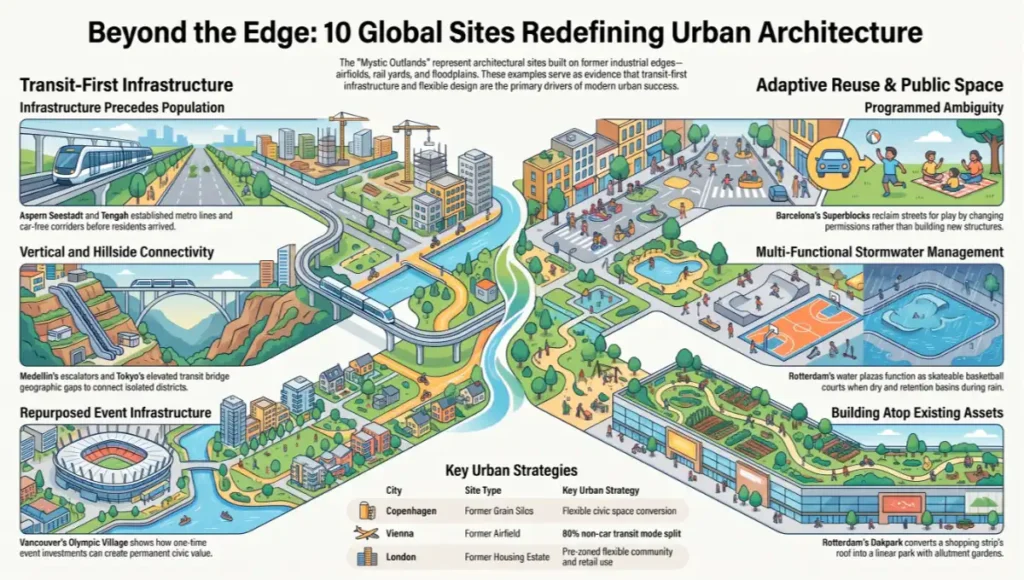
The case studies above establish the argument. The following ten sites let you test it in person. Each one sits at what used to be considered the wrong edge of its city — a former airfield, a rail yard, a harbor, a floodplain — and each one is reachable this summer by the same transit-first logic the Blueprint depends on. Visit them not as scenery, but as evidence.
1. Nordhavn, Copenhagen, Denmark
Copenhagen’s harbor-edge district converts former silos and industrial sheds into flexible civic space, with the metro’s driverless City Circle Line extension reaching the district directly. Walk the converted grain silo apartments and the harbor bath to see programmed ambiguity at full scale.
2. Tengah, Singapore
Singapore’s newest HDB town embeds a car-free town center and a 100-meter forest corridor into the plan before most residential towers were finished. The Community Farmway and the car-free center are open to visitors and demonstrate transit-first sequencing better than any rendering.
3. Nesselande and the Water Plazas, Rotterdam, Netherlands
Rotterdam’s Benthemplein water plaza and its wider Nesselande district turn stormwater retention into skateable, playable public space. Reach it by tram from Rotterdam Centraal and watch the sunken plaza function as a basketball court on a dry day.
4. Aspern Seestadt, Vienna, Austria
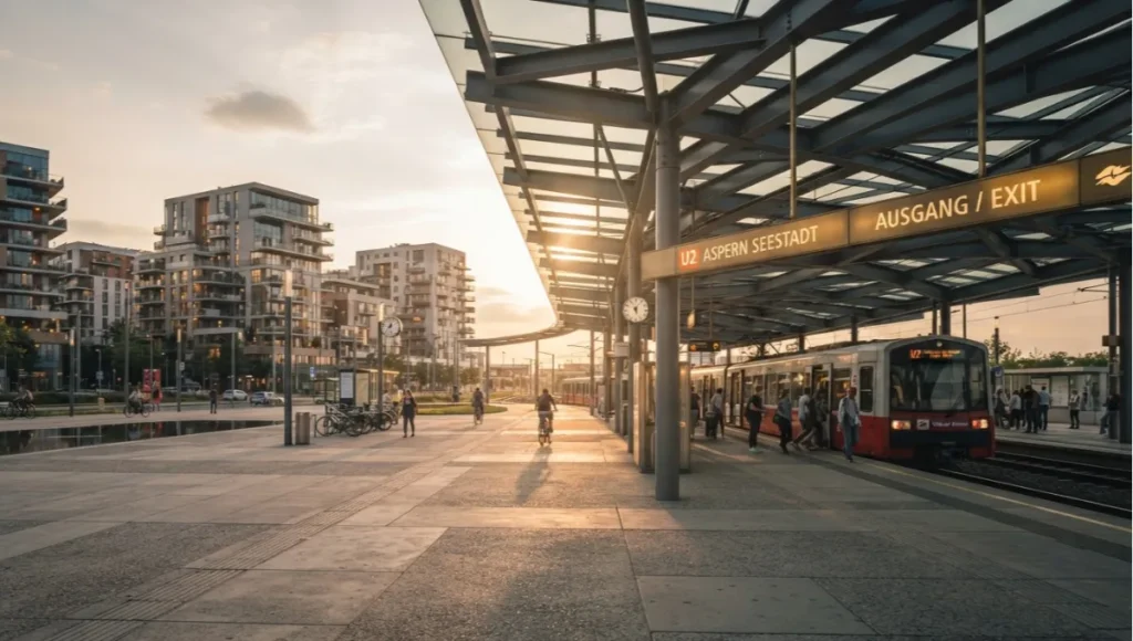
Built on a former airfield in Donaustadt, aspern Seestadt opened its U2 metro extension before most of its housing was occupied, targeting a 40 percent public-transit, 40 percent walking-and-cycling, 20 percent car mode split. The lakefront promenade and Seepark are open to the public and reachable directly from central Vienna.
5. Poblenou Superblock (Superilles), Barcelona, Spain
Barcelona’s superblock program reclaims former through-traffic streets in the Poblenou district for pedestrians, play, and outdoor civic life, without touching the underlying grid. It is one of the clearest demonstrations that programmed ambiguity does not require new construction — only a change in permission.
6. Toyosu Waterfront, Tokyo, Japan
Built on reclaimed land in Tokyo Bay and connected by the driverless Yurikamome line, Toyosu shows how the Blueprint’s layers stack vertically when ground area is scarce — elevated transit above, flood-resilient plinths below, and a market and waterfront promenade threaded between them.
7. False Creek, Vancouver, Canada
Vancouver’s former industrial waterfront around False Creek now combines a seawall pedestrian and cycling loop with mixed-income housing built to strict green-building standards. The Olympic Village district, in particular, shows how a one-time event’s transit and infrastructure investment can be repurposed into permanent civic value.
8. Comuna 13 and the Public Escalators, Medellín, Colombia
Medellín’s outdoor escalator system connects a hillside district long isolated from the city’s transit network to the Metrocable line below, cutting what was once a 30-minute climb to a six-minute ride. It remains one of the starkest real-world proofs that transit infrastructure, not architecture, is what determines whether an outland district thrives.
9. Dakpark, Rotterdam, Netherlands
A second Rotterdam entry earns its place on this list: Dakpark converts the roof of a shopping strip along a former rail corridor into a linear public park with allotment gardens, playgrounds, and a running track. It demonstrates that outland sites do not need to be vacant to be reclaimed — they can be built directly on top of existing infrastructure.
10. Elephant Park, London, United Kingdom
Built on the site of the former Heygate Estate near the Elephant & Castle transit hub, this district ties its housing directly to the London Underground and Overground interchange below it, with ground-floor units pre-zoned for flexible community and retail use — a live test of Layer Three of the Blueprint at city scale.
Concept Project Spotlight — Speculative / Internal Concept Study: Threshold Commons, by Nuvira Space
Threshold Commons is a speculative internal concept study developed by Nuvira Space’s urbanism team to test whether the Blueprint above could be compressed into a project small enough for a mid-size city to fund without national-level financing. It is not a commissioned or constructed project.
Project Overview: Location / Typology / Vision
Threshold Commons is sited on a hypothetical 14-hectare former rail-marshalling yard at the edge of a mid-size European city, bounded by an active freight corridor on one side and a flood-prone tributary on the other — precisely the kind of parcel most master plans quietly skip. The typology is mixed-use, mid-rise, with a maximum building height of seven stories to preserve sightlines to the surrounding topography. The vision is a car-free, transit-anchored quarter capable of housing roughly 6,000 residents while dedicating close to a third of its ground plane to water management and public space.
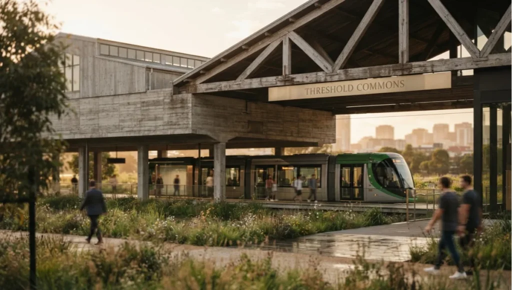
The study deliberately avoids the scale and ambition of a Tengah or a Nordhavn, both of which required national or metropolitan-level financing and decades of institutional continuity to deliver. Threshold Commons instead asks a narrower question: what is the smallest version of the Blueprint that still produces its full civic value, rather than a diluted fraction of it? The 14-hectare figure is not arbitrary — it approximates the size of a single disused rail yard, industrial siding, or freight terminal that exists in some form in most mid-size cities on every populated continent, which is precisely what makes the study transferable rather than site-specific.
Design Levers Applied
Transit and Mobility
- A single-line tram extension terminates inside the site, with every residential entrance within a 350-meter walk of the platform.
- Interior streets sized for pedestrians, cyclists, and emergency vehicles only; no private car parking above ground level.
Hydrology and Materials
- The tributary’s floodplain is folded into a linear park that also functions as the site’s primary stormwater retention basin.
- Ground-floor structural plinths sit 0.8 meters above the modeled 100-year flood line.
Ground-Floor Programming
- Former rail sheds retained and converted into a flexible market hall, permitted under the zoning overlay for four alternate civic uses.
- Utility stub-outs installed at 20-meter intervals beneath all ground-floor flexible space.
Transferable Takeaway
The core lesson of Threshold Commons is not the specific site plan, which is intentionally generic. It is that the three-layer Blueprint can be sized down to a single rail yard and a single tram extension — a scope small enough that a mid-size city’s existing capital works budget, rather than a national infrastructure fund, can plausibly finance it. Scale is not the barrier this study addresses. Sequencing is.
A second, quieter takeaway concerns governance rather than design. Because Threshold Commons is scoped to a single parcel with a single dominant landowner — in this case, a hypothetical municipal rail authority disposing of surplus land — it sidesteps much of the fragmented-approval problem described earlier in this article. Any city evaluating its own outland parcels should treat single-ownership sites as the highest-priority pilot candidates precisely because they remove one of the two dominant barriers to feasibility before a single design decision is made.
2030 Future Projection
By 2030, you should expect the phrase “outland” to lose most of its pejorative weight in planning documents, not because the land itself changes, but because sensor-driven maintenance and modular transit make marginal parcels measurably cheaper to activate than they were a decade earlier. Expect flood-retention infrastructure to be treated as a baseline civic amenity in any new mid-density district, following Rotterdam’s example, rather than a specialized add-on justified only in high-risk zones.
Expect transit-first sequencing, currently still the exception even in well-funded cities, to become close to standard practice in new districts built on formerly undesirable land, if only because the alternative — building housing first and hoping transit catches up — has now failed often enough to be politically indefensible. The cities that move first on this recalibration will not necessarily be the wealthiest ones; they will be the ones whose zoning authorities agree to merge decision-making before the next election cycle forces a restart.
Comprehensive Technical FAQ
Q: What distinguishes Mystic Outlands Architecture from ordinary transit-oriented development?
A: Ordinary transit-oriented development typically starts from an already-desirable parcel near an existing station. Mystic Outlands Architecture starts from parcels considered undesirable — floodplains, rail yards, drainage easements — and treats the extension of transit and resilient infrastructure into that parcel as the entire point of the project, not an afterthought.
Q: What minimum transit headway makes an outland site viable for this approach?
A: Field examples and the Blueprint above converge on a working range:
- Peak-hour headways of 6–10 minutes on the primary connecting line.
- Off-peak headways no longer than 15 minutes to preserve car-free viability for shift workers.
Q: How is flood risk typically modeled for these sites?
A: Reputable Blueprints size retention infrastructure to a 1-in-100-year storm event using current hydrological modeling rather than historical rainfall averages, since the latter increasingly understate risk under shifting precipitation patterns.
Q: Why does zoning fragmentation matter more than construction cost?
A: Construction cost is a known, budgetable variable. Approval delay across multiple jurisdictional authorities is not — it can add years of carrying cost to a project before a single structural element is built, which frequently kills feasibility long before the engineering does.
Q: Can this approach work outside dense European or Southeast Asian cities?
A: The underlying levers — transit-first sequencing, resilient hydrology, flexible ground-floor zoning — are not climate- or geography-specific. What varies by region is which barrier dominates: land speculation tends to dominate in fast-growing markets, while fragmented zoning authority tends to dominate in older, multi-jurisdiction metropolitan regions.
Q: What role do sensors and data infrastructure play, beyond monitoring?
A: In a properly instrumented outland district, sensor data does three jobs at once: it verifies that retention infrastructure is performing to its modeled capacity, it feeds transit agencies real ridership data to justify headway adjustments, and it gives programmed ground-floor spaces the occupancy data needed to negotiate their next reprogramming cycle with municipal permitting offices. Without this feedback loop, a Blueprint is a one-time construction decision. With it, the Blueprint becomes an adaptive system that a city can continue tuning for decades after the ribbon-cutting.
Q: How should a municipal government sequence its first outland pilot?
A: A defensible sequence, drawn from the case studies above, typically follows this order:
- Commission independent hydrological and transit-demand modeling before any architectural design work begins.
- Secure financing for the transit spine and drainage infrastructure through an instrument insulated from a single budget cycle.
- Draft the zoning overlay with pre-approved alternate uses before construction, not after occupancy.
- Instrument the site with sensors from day one, rather than retrofitting monitoring after early performance questions arise.
Plan Your Next Field Visit With Nuvira Space
If you are responsible for planning decisions in your own city, the fastest way to understand whether an outland parcel is viable is to walk one that has already worked. Rotterdam’s water plazas, Singapore’s Tengah town center, and Copenhagen’s Nordhavn waterfront are all open to the public and reachable by the same transit systems this article argues for. Bring a notebook, not a camera. Measure the walk from the nearest platform to the furthest residential entrance.
Talk to a resident about what the ground floor was originally zoned for and what it has quietly become instead. Nuvira Space will continue publishing the Urban Pulse series to track which cities close the gap between speculative concept studies like Threshold Commons and funded, built infrastructure — subscribe to follow the next site as it develops.
© Nuvira Space — All rights reserved. | URBAN PULSE Series | All specifications cited are based on publicly available municipal and transit authority planning documents for the cities referenced; no external links implied. Threshold Commons is a speculative internal concept study and does not represent a completed project.